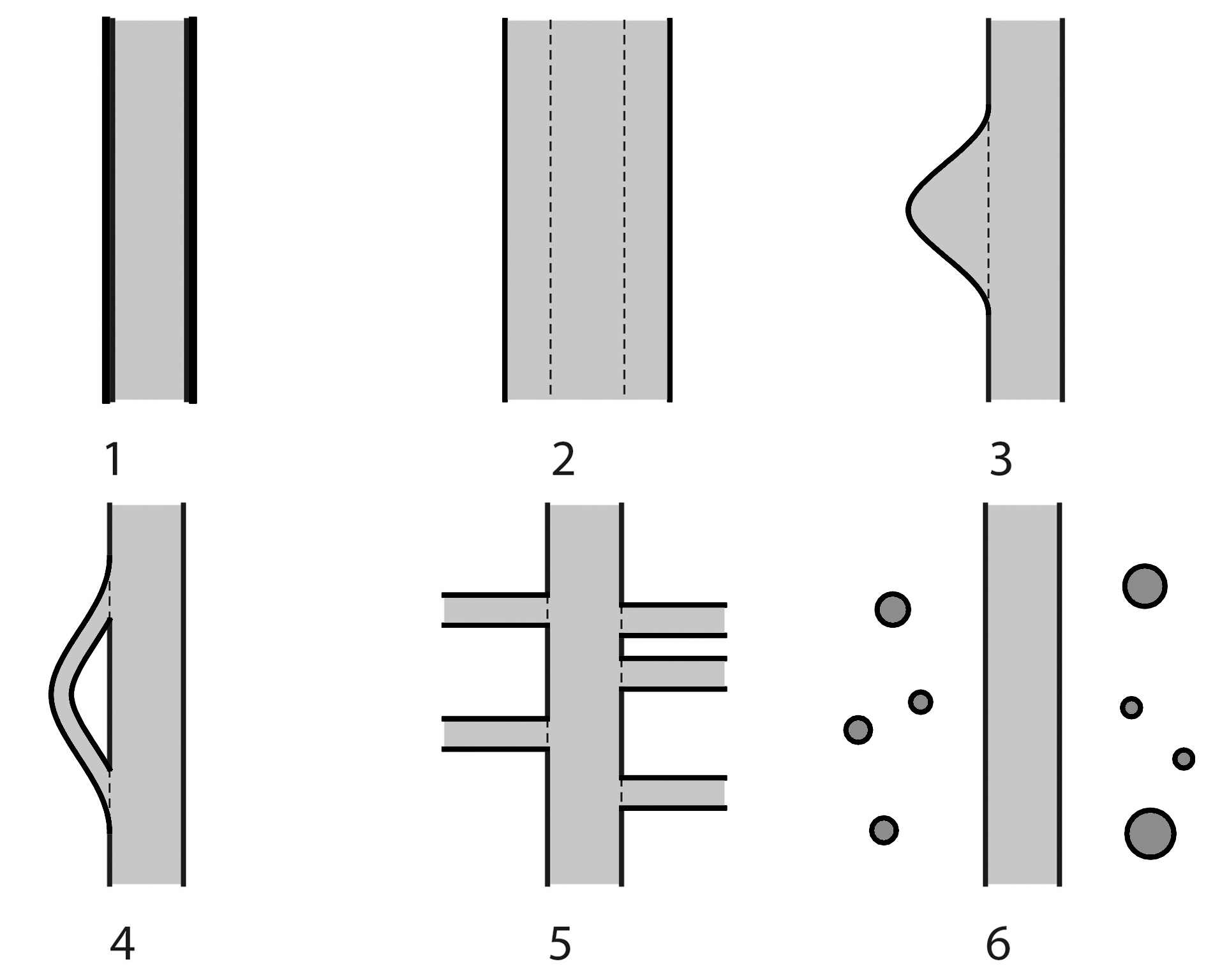
URBAN FLOODING RISK MITIGATION. SIX STRATEGIES FOR INTERVENING ALONG RIVERS
introduction
Gaetano De Francesco
This paper is the third in a series published in l’industria delle costruzioni since 2018 and represents the third stage of a reflection on urban flooding. The first essay drew attention to the issue of the capillarity of water networks as a sustainable model for the territory; the second attempted to highlight the potential of water emergencies as an opportunity for urban revitalization. The topic discussed here is river overflow, examining the actions to mitigate this risk in the contemporary city. By their nature, rivers overflow from their banks during flood events. Since ancient times, man has operated on the river network to cope with the problem of urban flooding by building dams, widening riverbeds, diverting their courses or altering their layout. On the one hand, the anthropogenic action of hydrographic network transformation has allowed human settlements. On the other hand, it has compromised its stability and ecosystem balances. Harnessing rivers, cementing their banks and increasingly occupying the spaces naturally destined for overflow have become the cause of catastrophic flooding within the land, built and unbuilt. In addition, the increase in short-time precipitation and extreme weather events in recent decades has worsened urban flooding. The need to mitigate flood risk and provide large tracts of the city with public spaces for socializing, recreation and sustainable mobility routes, as well as the desire to renaturalize the riverbanks, has led municipalities to undertake radical transformations of river margins with the creation of new buffer spaces for water collection and discharge.


